What is DEM
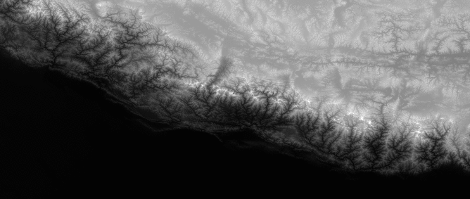
Earth’s relief is the basic information to be shown on a map and digital elevation models (DEM) are widely used for that kind of representations. The Digital Elevation Model (DEM) is a 3D digital representation of elevation data of the earth’s terrain. DEM is the most common basis for digitally created relief maps. It can be represented as a raster file (a grid with elevation data for each raster cell) or as a vector-based Triangular Irregular Network (TIN). The DEM could be acquired through techniques such as photogrammetry, lidar, IfSAR or InSAR, land surveying, etc and is commonly built using data collected using remote sensing techniques, but it may also be built from land surveying.
What is SRTM project
In 2000, within the international project of the National Aeronautics and Space Administration (NASA) and the National Geospatial-Intelligence Agency (NGA), special radar technology on board the space shuttle Endeavor was used to collect interferometric radar data, which compared two radar images or signals taken at slightly different angles. These data were used to create the first near-global raster data set of land elevations – all land between 60° North and 56° South latitude, which comprises almost 80% of the Earth’s total landmass. At first, SRTM data for regions outside the United States were provided to the public at 3 arc-seconds – 1/1200th of a degree of latitude and longitude, or about 90 meters (295 feet). But form 2015 the data have been released globally with a 1 arc-second resolution – about 30 meters (98 feet) – in the full resolution of the original measurements.
How to get DEM for specific area:
A quick and easy way to get your own raster DEM from SRTM data is to use the tool “DEM from SRTM” which allows to download high-resolution digital elevation model (DEM) on a near-global scale, originating from SRTM project. You can download the DEM according to your requirements in three easy steps:
- Go to the DEM from SRTM tool.
- Define the area of interest to download the DEM from.
- Set the cell size of the output raster.
- Set output file format and coordinate system.
The resolution of DEM is 1-arc second (30 meters). The area of interest specifying the data to be extracted from the SRTM can be defined by uploading a polygon vector file in all common GIS formats, or by drawing the area on a map. There are several output raster formats that can be selected to download the DEM – e.g. GeoTIFF, ArcInfo ASCII Grid, ESRI .hdr Labelled, GeoPackage, Golden Software 7 Binary Grid (.grd), ASCII Gridded XYZ or USGS Optional ASCII DEM. It is possible to transform the resulting DEM to all common coordinate systems.
What to do with DEM
There is a wide range of spatial analyses where DEM necessary, such as flood, avalanche or landslide hazard assessment, soil properties or location of a telecommunication tower, as well as image orthorectification. Some of those applications require shape and topology description based on data extracted from DEMs, such as slope maps, drainage networks or watershed delineation. Last but not least, DEM can also be used in the gaming industry to create realistic landscapes in games (e.g. flight simulators) or in transportation sector for Intelligent transportation systems (ITS) or Advanced Driver Assistance Systems (ADAS).
Common uses of DEMs:
- Slope: You can create a map describing the slope for each raster cell based on the elevation.
- Aspect: A map displaying the aspect (the downslope direction of the maximum rate of change in value from each cell to its neighbors – slope direction to north, south, …).
- Hillshade: A map representing a shaded relief by considering the illumination source angle and shadows. The resulting map could be easier to interpret than the original DEM, because some topographic features are better visible.
- Curvature: The curvature map basically calculates the relative change in slope – the second derivative value of the input surface on a cell-by-cell basis.
- Contour: There can be plotted topographic contour lines. Based on the user defined parameters the new map will display (elevation based) contour lines.
- Visibility analyses: Using DEM it is possible to analyze and visualize viewsheds (Line-of-sight analysis) or observer points.
- Water flow modeling
- Topographic profile of a line using DEM
In general, DEMs are useful for landscape analysis. These include, for example, hydrological analysis, geological and geomorphological analysis and landscape development.